Ann Wroe in 1843 Magazine:
 In spring thoughts traditionally turn to travelling, and so to maps. This was always something of a ritual in our house. Out of the bottom desk-drawer they’d come: the shiny Ordnance Surveys, the dog-eared city guides, the family treasures backed with canvas or patched with tape. Into the glove-compartment some would go, among the pens and receipts and whitening chocolate bars. We were halfway there already. Last year’s road map, already in a tattered state, would be thrown on the back seat. We had much less affection for that. Like the pale, flat Google Maps now on our phones, or the relentless black curve of the SatNav, this was a dull thing.
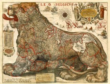
…Old maps assume that travel will be difficult, but they give it interest. The roads that meander through 17th-century county maps pass small pyramidal hills, copses, settlements and steeples, which look worth a visit. On medieval maps what seem to be roads may actually be rivers, snaking to alarming dead ends – you’ll be well-mired and stranded whichever way you go. Yet here is a building with turrets and vanes, there a train of laden camels, over there a Great Khan with turban and beard sitting, in a welcoming way, under a striped pavilion. And out in the sea great whales are surfacing and blowing.
Modern 1:25,000 maps have much the same allure.
More here.
